About the Five Mile Point Rocky Shore Area
Description
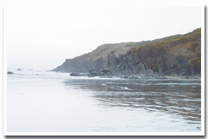
Five-mile point is a small rocky point with intertidal habitat south of Cape Arago, approximately 0.5 miles north of the Whiskey Run Beach access road. |
|
Designation
The beaches and rocky shores of Oregon are part of Oregon’s Ocean Shore Recreation Area and the offshore rocks and islands are part of the Oregon Islands National Wildlife Refuge. |
| |
|
|
Key Resources
Some of the only rocky intertidal habitat between Cape Arago and Bandon with limited seabird and harbor seal use of nearby offshore rocks. |
|
What can you do here?
Typical uses include beach recreational activities like beach combing and some tidepooling, bird watching, along with some mussel and razor clam collecting. |
Getting to the Rocky shore at Five Mile Point
Access to Five Mile Point is possible from both the north (Seven Devil’s SRS) and the south (Whiskey Run Beach). Access from the north is only possible at low tides and either access requires a walk along the beach to reach the intertidal area at the point. Seven Devil’s SRS is located approximately 10 miles north of Bandon, off Hwy 101 (follow signs to the state park and Whiskey Run). Before Seven Devils (approximately one mile off 101), turn left onto Whiskey Run Road and follow the road until it ends. There is a small parking area but no on-site facilities.
 Public Access Option 1 for Five Mile Point Rocky Shore Public Access Option 1 for Five Mile Point Rocky Shore
Public Access Option 2 for Five Mile Point Rocky Shore
Who Owns this Site?
Submerged and submersible (intertidal) lands: Division of State Lands with all adjacent uplands in private ownership, except for a parcel to the north which is owned by Oregon Parks and Recreation Department and managed as Seven Devil’s State Recreation Site. |
|
Who Manages this Site?
Seven Devil’s State Recreation Site to the north is part of ORPD area 4 and is in the Bullards Beach Management Unit. Oregon Parks and Recreation Department manages the ocean shore recreation area. |
|
Data for the Five Mile Point Rocky Shore
[2 Records Listed]
Five Mile Point Rocky Shore GIS Data |
Data Layer |
Source |
Scale |
Year |
Download |
|
USGS |
24,000 |
1994 |
|
|
USGS |
24,000 |
1973 |
|
[2 Records Listed]
Information compiled by Laurel Hillmann, NOAA Coastal Management Fellow, OPRD |