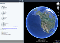
 Oregon MarineMap is a web-based tool for open and participatory spatial planning in the marine environment. It was developed to support Goal 19 of Oregon's Statewide Planning program which requires the state "to conserve marine resources and ecological functions for the purpose of providing long-term ecological, economic, and social value and benefits to future generations."
-->> Click Here to Launch Oregon Marine Map <<--
For more Information on the Territorial Sea Plan:
For more information on the Oregon MarineMap Project Partners
MarineMap Consortium
Oregon Department of Land Conservation and Development
Oregon Department of Fish and Wildlife
Oregon Wave Energy Trust

