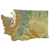
 The Washington State Geospatial Clearinghouse is a node on the NSDI national network of spatial information servers. The Clearinghouse provides a single point of access to geospatial information across Washington. The goal is to make access to spatial information technologies more efficient.
To connect to the Washington State Geospatial Clearinghouse use the following link:
http://wa-node.gis.washington.edu/geoportal/catalog/search/search.page
This Geospatial Clearinghouse provides a single point of access to geospatial information across Washington. The portal acts as a gateway to an extensive metadata catalog -- this is a master inventory where users can find standard information about available geospatial data sets.
The Washington State Geospatial Clearinghouse is a node on the NSDI national network of spatial information servers. The project was established in 1998 as a result of a partnership between the Washington Geographic Information Council (WAGIC), the Washington Department of Information Services (DIS) and the University of Washington (UW) Libraries. An agreement was developed between DIS and UW to permanently host the clearinghouse platform at the UW Libraries.