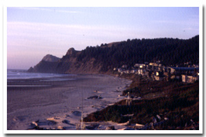
Here identified as the Lincoln littoral cell, this sandy 20 mile segment of Oregon's coastal shoreline extends from mileage Cascade Head to Cape Foulweather. It is associated with the Salmon, D, and Siletz rivers mouth(s) and accompanying Salmon River Estuary.
The Lincoln sandy shore lies within Lincoln County and makes up the shoreline fronting the communities of Lincoln City and Depoe Bay. It consists of Dune Backed, Inlet Affected and Bluff Backed shoreline. Of this shoreline approximately 59% is urban and 30% is park. An unknown percentage of this stretch of sandy shoreline is hardened with shore protection structures. Predominant land uses include those typical of urban, ruralsettings.
Chronic coastal hazards for the Lincoln sandy shore include ocean flooding and erosion, inlet migration, landsliding and sloughing and sand inundation. Catastrophic hazards include earthquakes, and the groundshaking, subsidence, landsliding, liquefaction, and tsunami that accompany them.
Key recreational facilities and cultural features include: Cascade Head Preserve, Roads End State Park, and Depoe Bay Harbor. |