Planning for Improved Public Access on the Oregon Coast

Planning for Improved Public Access
on the Oregon Coast
Welcome! This tool aims to provide easy access to information on shoreline access sites within local jurisdictions in the Oregon coastal zone, in order to assist informed decision-making for the preservation and enhancement of coastal shorelines. The viewer is intended to be used in conjunction with the "Oregon Coastal Public Access Guide for Local Government Planners"
Information displayed here is intended to help local governments assess the vulnerability of access sites, where access sites and amenities are located and where different amenities are insufficient for community needs. The tool can aid in understanding where ideal locations might occur for additional access site, avoiding vulnerable locations and where sensitive habitats and species may occur, and may also be useful to local governments in applications for funding to increase access sites and help improve coastal access amenities.
About this Project
This tool was developed by the Oregon Coastal Management Program, which is administered by the Oregon Department of Land Conservation and Development. Multiple partners and members of the Coastal Access Advisory Team also provided review and support for these resources. We would like to thank those who provided input to this planning guide and associated resources:
Coastal Access Advisory Team Members
- Oregon Parks and Recreation Department
- Oregon Department of Environmental Quality
- Oregon State Marine Board
- Department of Land Conservation and Development
- Coquille Indian Tribe
- Confederated Tribes of the Coos, Lower Umpqua and Siuslaw Indians
- City of Bandon
- Clatsop County
- Empowering Access
- Oregon Surfrider
- Oregon Shores Conservation Coalition
- National Coast Trails Association
- Oregon Coast Visitors Association
Funding
The project was funded by a §309 Project of Special Merit grant, awarded to the Oregon Coastal Management Program under the Coastal Zone Management Act of 1972, as amended, administered by the Office for Coastal Management, National Oceanic and Atmospheric Administration.
Menu of help topics
Public Access Site Information
Information displayed in the map is intended to help local governments assess the vulnerability of access sites, where access sites and amenities are located and where different amenities are insufficient for community needs.
 Inventoried access sites include both active access locations, as well as locations inventoried and protected for future access.
Public Access locations in the Oregon coastal zone were inventoried in the field in 2020.
Information about Underdeveloped Access
Information from this map is intended to be used in conjunction with the "Oregon Coastal Public Access Guide for Local Government Planners". Underdeveloped Public Access or access amenities were selected via a process specified by the Coastal Access Advisory Team. Details about these selections are explained below.
 Public Access sites missing one or more basic access amenities such as parking, restrooms or trails.
 Public Access sites without disability access amenities.
 Public Access sites designated for boating that are unimproved or missing boating access amenities.
This map interface contains the following simple tools to assist with common tasks.
 Click to Zoom in (+) or Zoom out (-) on the map. Mouse wheel (desktops) or pinch control (tablets or phones) also available.
 Open up a list of coastal locations, and select to zoom directly to a specific community or county.
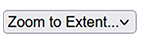
 Return the map to full extent. Zooms back out to the starting geography.
Map Customization & Sharing
 Availble under "Map Extras" in the Layer list. Use these Drawing and Markup tools for drawing temporary sketches on top of the map. Includes the option to upload overlay information onto the map from KML or GeoJSON files, and final sketches may also be downloaded in those formats for use elsewhere. Useful for annotating project ideas.
 Print the map to a PDF that you can use offline. Select page orientation, map resolution, and add a custom title. The finel PDF will contain your visible annotations and sketches.
 Get the exact URL for the current map composition, including visible layers and current extent. Useful for sharing. **
 Reload the entire map document. This will load a clean copy of the map, and will remove any sketchs or annotations.
Additional tools may be added over time.
Further information related to data in this tool can also be explored in the following locations:
- EJScreen: Environmental Justice Screening and Mapping Tool (EPA)
- Compass: Mapping Oregon’s wildlife habitats - An online data and planning tool
- Oregon Sea Level Rise Impacts Explorer
- DOGAMI Tsunami Evacuation Maps
- Oregon Shore Explorer
Local governments that would like jurisdiction-specific extracts may contact OCMP for use in desktop GIS.