Description
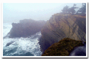
The rugged coastline that fronts Shore Acres State Park (approximately 13 miles SW of Coos Bay) is located just to the north of the Cape Arago headland and is bordered to the north by Sunset Bay State Park and to the south by Cape Arago State Park. |
|
Designation
 Shore Acres Park is part of the Cape Arago Headland research reserve, with the majority being part of area “B” which is defined as “all rocky areas, tide pools, and sand beaches situated between extreme high tide and extreme low tide lying between the southern tip of Norton Gulch and Simpson Reef overlook.” Shore Acres Park is part of the Cape Arago Headland research reserve, with the majority being part of area “B” which is defined as “all rocky areas, tide pools, and sand beaches situated between extreme high tide and extreme low tide lying between the southern tip of Norton Gulch and Simpson Reef overlook.” |
| |
|
|
Key Resources
Intertidal communities and a few small seabird colonies on the associated rocks in the area. |
|
What can you do here?
Most use along this section of coast is confined to upland trails and the botanical gardens, however sightseeing, hiking, storm and whalewatching, and tidepooling are also popular activities. Shore Acres is designated as part of the Cape Arago research reserve (area B), therefore, collection of intertidal shellfish and invertebrates is limited (see current ODFW fishing regulations for a list of species and exact boundaries), except by scientific permit. |
Educational Opportunities
There is a fully enclosed observation building that affords visual access of the ocean while being protected from the often-stormy weather. There are interpretive panels describing the history of the area, specifically the Simpson estate that used to rest on the same spot as the shelter.
Getting to the Rocky shore at Shore Acres
Access to shore level is via a paved trail from Shore Acres State Park (which begins near the formal gardens). From HWY 101 in Coos Bay, follow signs to Charleston/State Parks. From Charleston follow the Cape Arago Highway approximately four miles to Shore Acres.
 Public Access Option 1 for Shore Acres Rocky Shore Public Access Option 1 for Shore Acres Rocky Shore
Who Owns this Site?
Submerged and submersible (intertidal) lands: Division of State Lands; beach and upland area: Oregon Department of Parks and Recreation (Shore Acres State Park). |
|
Who Manages this Site?
  Oregon Parks and Recreation Department manages Shore Acres State Park as part of OPRD Area 4 (south coast) and the Sunset Bay Management Unit. Oregon Parks and Recreation Department manages the ocean shore recreation area. ODFW manages the site
as a Research Reserve Oregon Parks and Recreation Department manages Shore Acres State Park as part of OPRD Area 4 (south coast) and the Sunset Bay Management Unit. Oregon Parks and Recreation Department manages the ocean shore recreation area. ODFW manages the site
as a Research Reserve |
|