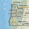
 The Oregon Spatial Data Library (OSDL) provides public access to reliable and up-to-date spatial data. Currently the OSDL contains several hundred data sets, including all of the statewide framework data available for Oregon. These data sets can serve as base data for a variety of applications to support research, business and public services.
The Oregon Spatial Data Library is a joint effort between the Department of Administrative Services Geospatial Enterprise Office and Oregon State University.
Framework data sets include administrative boundaries, transportation, land use and ownership, water, hazards, and wetlands.
You can access the Oregon Spatial Data Library at this link.
