About the Castle and Gull Rocks Rocky Shore Area
Description
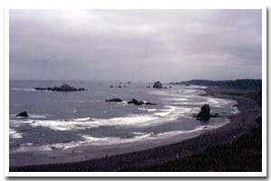
Castle and Gull Rocks are located between Cape Blanco (to the south) and Blacklock Point (to the north) offshore of the Sixes river mouth, in Curry County, Oregon. |
|
Designation
Offshore rocks and islands are part of the Oregon Islands National Wildlife Refuge (NWR). |
| |
|
|
Key Resources
Several harbor seal haulouts and a significant number of seabird colonies, including common murres, pelagic cormorants, and double crested cormorants with some use by endangered brown pelicans. |
|
What can you do here?
Access to all offshore rocks is prohibited, as they are part of the Oregon Islands NWR. |
Getting to the Rocky shore at Castle and Gull Rocks
Access is by boat only, although all access to offshore rocks is prohibited, as they are important habitat for seabirds and marine mammals.
 Public Access Option 1 for Castle and Gull Rocks Rocky Shore Public Access Option 1 for Castle and Gull Rocks Rocky Shore
Who Owns this Site?
Submerged and submersible rocks: Division of State Lands; offshore rocks above Mean High Water: U.S. Fish and Wildlife Service. |
|
Who Manages this Site?
 The offshore rocks are managed as part of the Oregon Islands NWR. The offshore rocks are managed as part of the Oregon Islands NWR. |
|
Data for the Castle and Gull Rocks Rocky Shore
[2 Records Listed]
Castle and Gull Rocks Rocky Shore GIS Data |
Data Layer |
Source |
Scale |
Year |
Download |
|
USGS |
250,000 |
1981 |
|
|
ODOT |
6,000 |
1967 |
|
[2 Records Listed]
Information compiled by Laurel Hillmann, NOAA Coastal Management Fellow, OPRD |